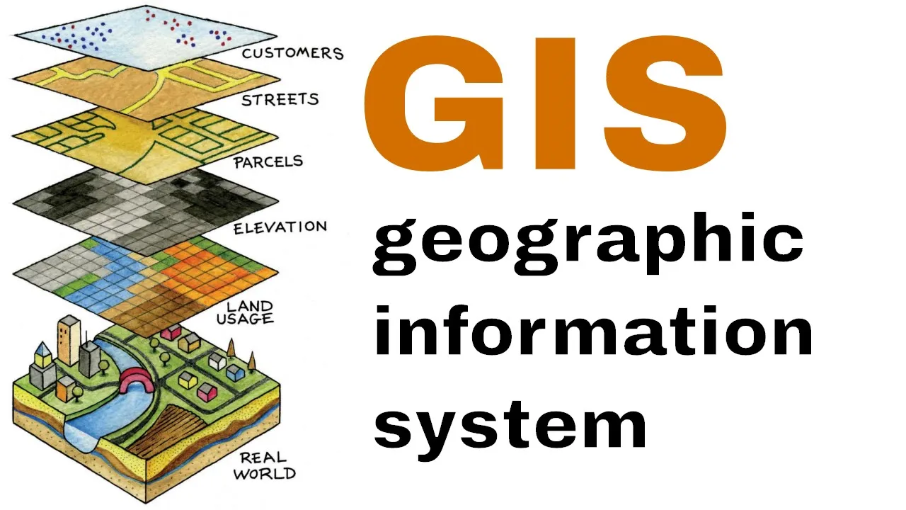
Geographic Information System GIS
100
Acquired Skills
- Using Photogrammetry, Remote sensing, Cartography, Google Earth and GPS
- Building, Editing and Reviewing data in GIS
- Integration between GIS and AutoCAD
Course Duration/Hours
30 Hour
100
30 Hour